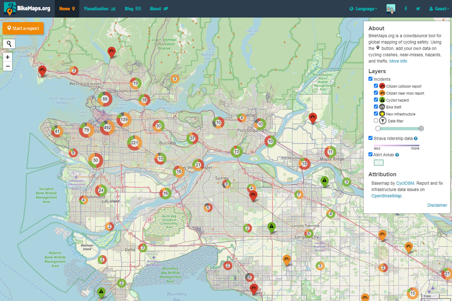
A new map to help cyclists plan a safe route is now live.
BikeMaps.org allows injured cyclists to indicate dangerous curbs or turns as a warning to other cyclists. The map indicates hot spots for bike theft, collision reports, cyclist hazards and citizen near miss reports. Participation is quick, anonymous, and is done by pinning a marker on the online map.
Trisalyn Nelson, an avid cyclist, geographer, and Lansdowne research chair of spatial sciences at the University of Victoria, began the project. In the first few days of the pilot project, more than 150 reports have been filed across Canada, the US and as far as Finland.
Although BikeMaps began as a local initiative, Nelson hopes that the map becomes a global resource and remedy safety fear, “the number one deterrent” to new cyclists. The city of Victoria will be looking to the map to help indicate where to invest in cycling infrastructure.
According to the Times Colonist, ICBC recorded 220 incidents in 2012 – a rise of almost 16 percent in just two years. Nelson says that ICBC and police data do not reflect bike accidents if there is no vehicle insurance claim or police response. Specific information on these collisions should be tracked to create safer routes for cyclists.
“If we want to get people on the road, we need to make cycling safer. And unfortunately, we have to turn the lens onto risk in order to get the data that we need to make cycling safer,” Nelson said.
For more information:
- BikeMaps.org
- University of Victoria geographer helps track cycling hazards, Times Colonist
- An app helping cyclists avoid hazards in the works at UVic, Global News


